A living digital twin for Colombia's Magnolia cloud forest
Fundación Magnolios flew, mapped and modelled its own reserve — then used Svarmi's DATACT platform to turn that drone data into a living digital twin. The result allows for a steep and remote Andean cloud forest to be explored, understood and its secrets revealed, from species discovery to global impact storytelling.
Safeguarding Colombia's endemic Magnolia trees
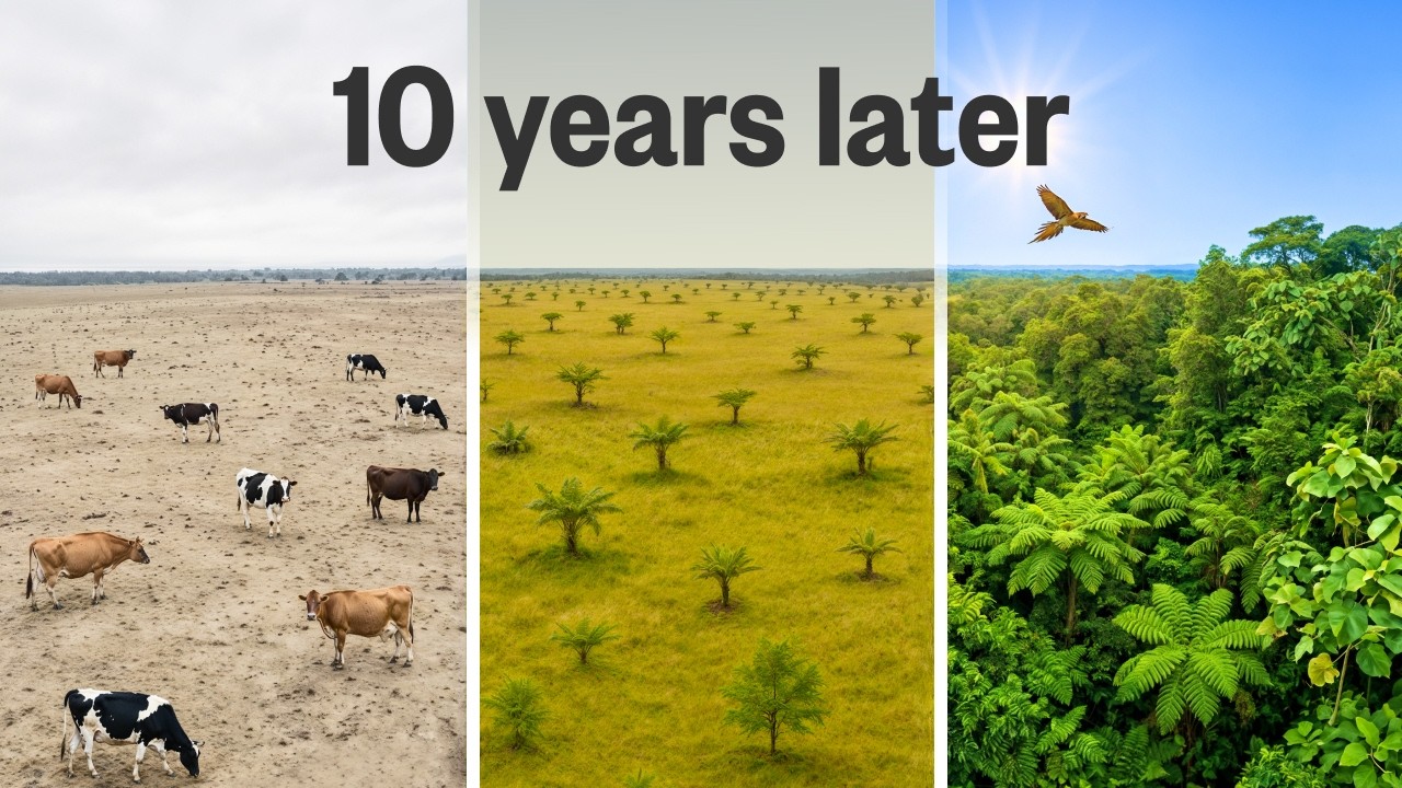
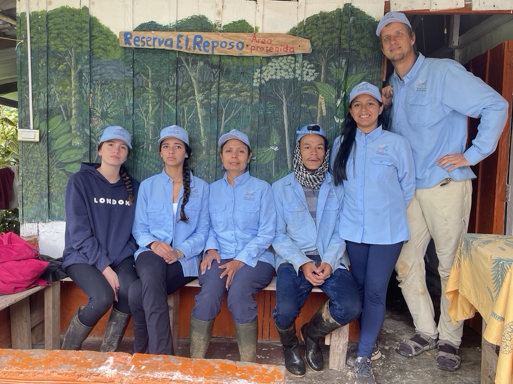
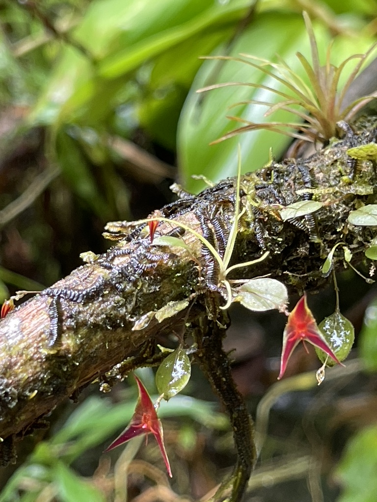
Fundación Magnolios protects and expands the 850 hectare Los Magnolios Nature Reserve, safeguarding Colombia's endemic and endangered Magnolia tree species — including the extremely scarce Magnolia polyhypsophylla — alongside iconic fauna such as the jaguar and the puma. Set at the northern end of Colombia's Central Andes, between the Andes, the Caribbean plains and the species-rich Darién Gap, the reserve packs a remarkable range of altitudes and microhabitats — such as steep cloud forest, isolated forest patches and small wetlands — into a small area. It is also extraordinarily wet (rain falls there about three times more than e.g. in Switzerland), and that humidity drives a wealth of evergreen species, epiphytes and amphibians.
Through science-driven forest protection, species propagation and community-led ecotourism, the foundation guards a critical conservation hotspot — habitat to five of Colombia's wild feline species — while contributing to the identification of new species. The reserve's forests form part of a Verra-registered carbon credits project, documented in hundreds of pages of audited and peer-reviewed data.
Rigorous data the world never gets to see
Modern conservation rarely fails for lack of data — it fails on visibility. Los Magnolios is documented in extraordinary detail: hundreds of audited pages for its carbon credits project, a 100-page biodiversity report to Colombia's Environment Ministry, and ongoing species science. Scientifically, the evidence is there. But it stays locked in technical reports that auditors and specialists read, while donors, journalists, policymakers and communities almost never do.
Websites and social media, while important, don't close that gap. They reward the spectacular and the short-lived, and struggle to carry ecological complexity, uncertainty, baselines and long-term time series — the things that actually build trust. They rarely show evidence or sources, and the foundation controls neither the algorithms nor how long a platform stays relevant. What the team needed was a single, lasting place anyone could understand without being an expert — that excites, but also lets people verify.
What I need is not only a narrative, but — in an accessible way — evidence, proof and long-term stability of information. Christian Dannecker · Director & Founder, Fundación Magnolios
From their own drone data to a navigable digital twin
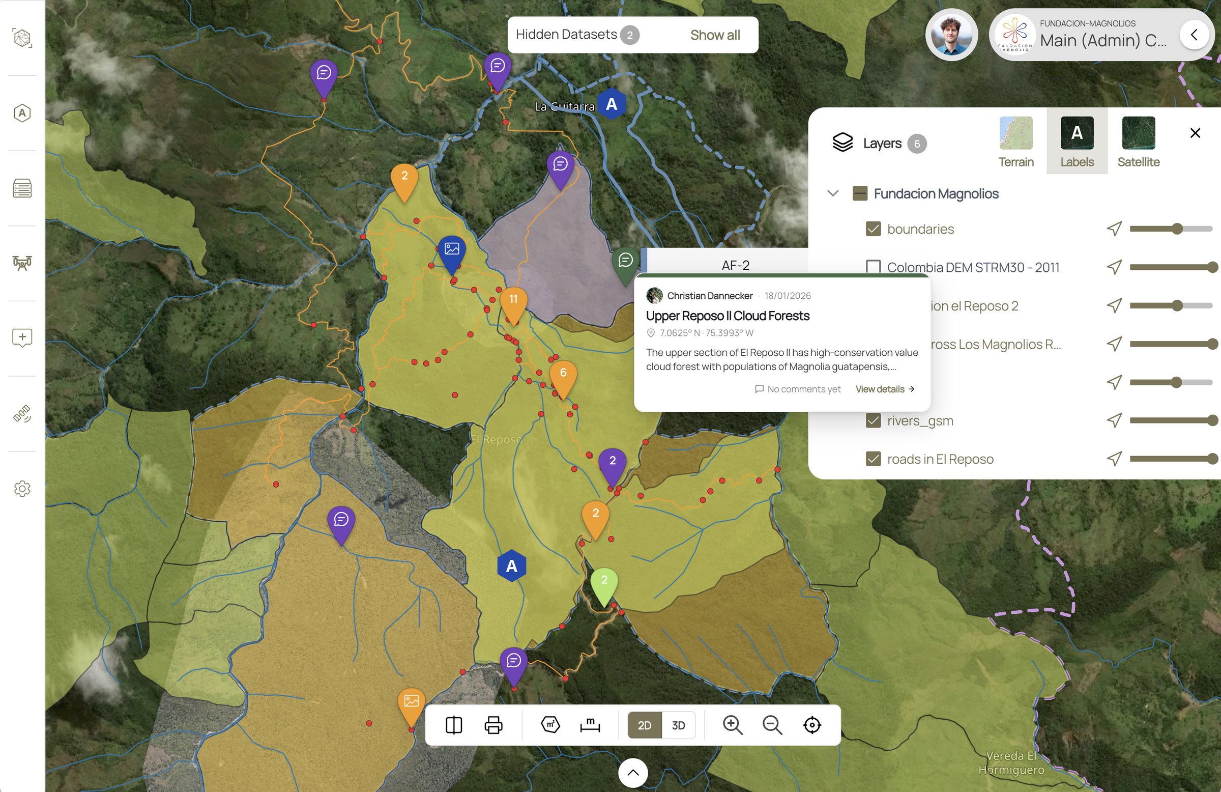
Fundación Magnolios flew and mapped the reserve themselves, then brought that imagery into Svarmi's DATACT platform. As Marco Hirsbrunner puts it, DATACT "puts all the data into its right place, both in space as well as in time." Unlike heavyweight GIS tools, it's easy enough that non-experts can explore the maps directly — layering drone panoramas, photos of activities and wildlife-camera shots so you feel immersed in the project, while still processing very large datasets behind the scenes. The team decides exactly what to share, and with whom: a third-party auditor, a funder, or the public.
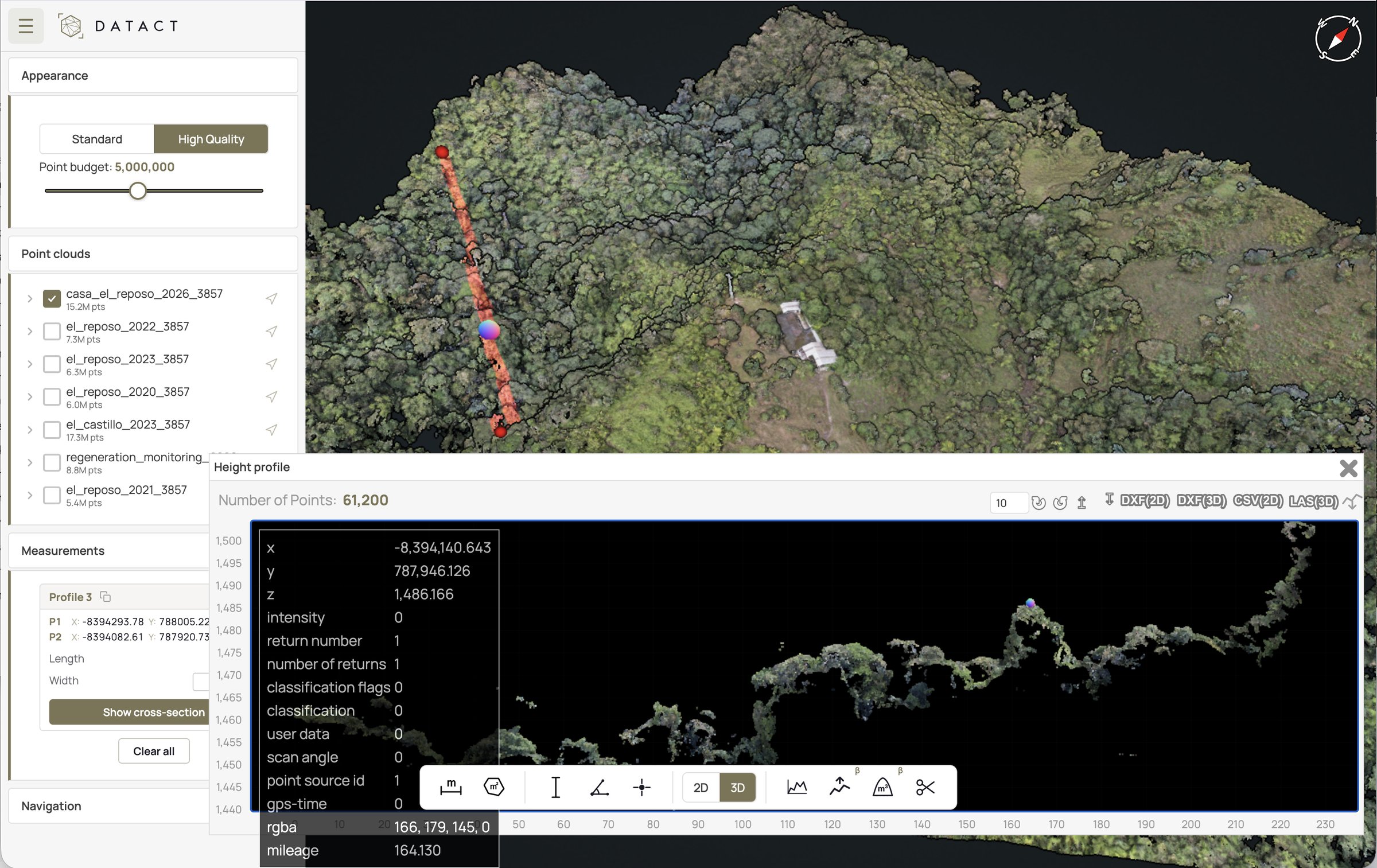
Years of drone surveys (2020–2026) held side by side as 3D point clouds, with height profiles, cross-sections and DXF/CSV/LAS export for auditors.
Key benefits of DATACT for Fundación Magnolios
Self-served mapping
The team flies its own drones and turns the imagery into a digital twin in DATACT — no external survey crew required. Conservation organisations can own their data from the first flight.
Verifiable progress
Repeat surveys, layers and geotagged evidence make change over time measurable and auditable — backing forest carbon monitoring and on-the-ground progress checks with visual proof.
Stakeholder trust
Interactive maps let donors, scientists, partners and communities see exactly what is happening on the ground — turning abstract impact into something explorable and believable.
Field discovery & seed work
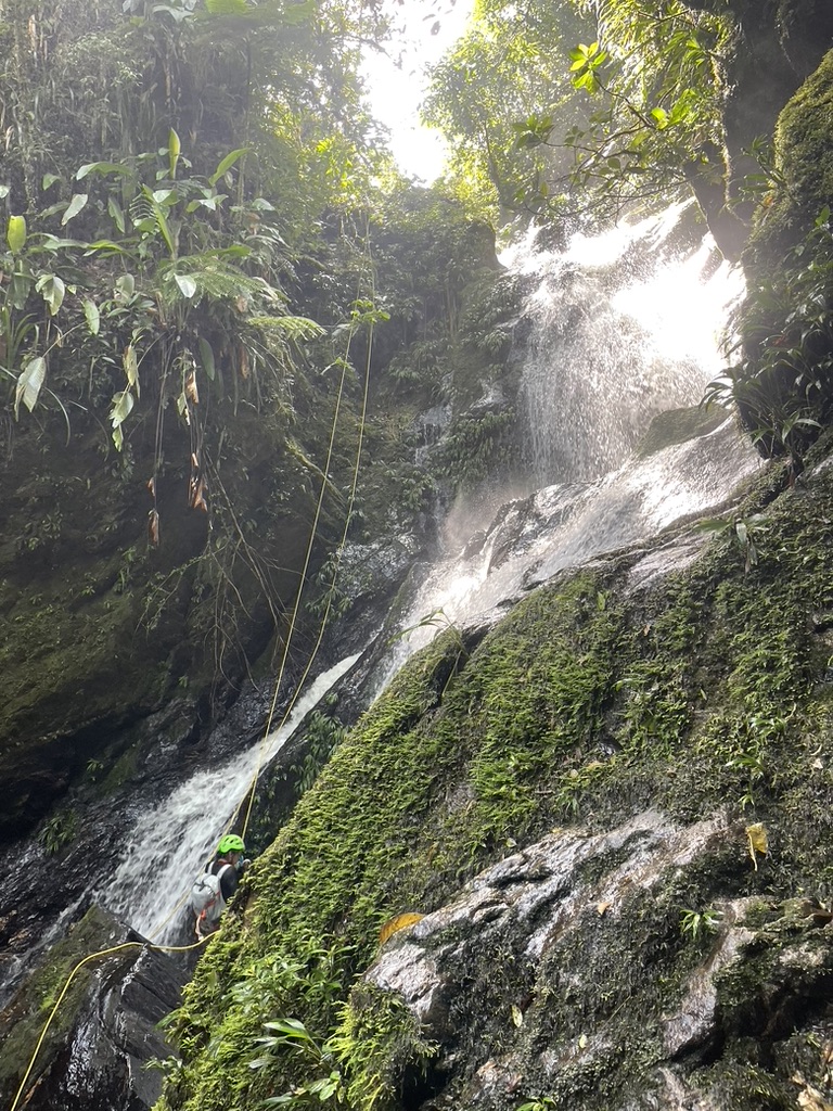
A standing tree isn't enough — many Magnolias are slow-reproducing "ghost populations." Drones help spot the rarest individuals in the canopy; the team then reaches them across steep terrain to collect seeds at the right moment, feeding propagation and the search for new species. A project to also use drones for seed harvesting is being piloted.
If we get transparency and storytelling right, conservation stops being something people just consume and becomes something they can actually understand and engage with on an ongoing basis.
Building the case for Planet Wild & Ecosia
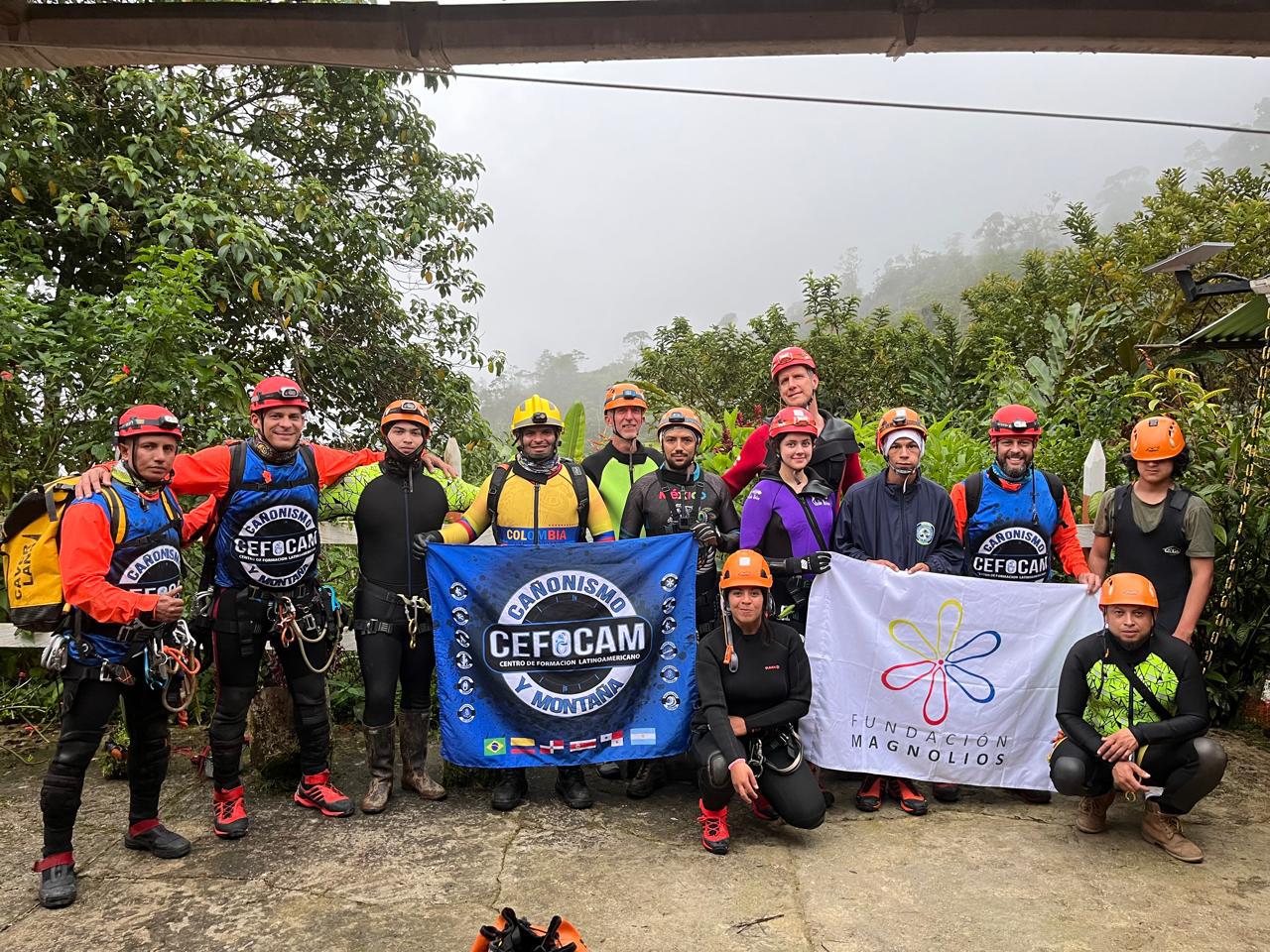
A clear, verifiable picture of the reserve helped Fundación Magnolios prepare for its collaboration with Planet Wild and Ecosia — funding an expansion of the protected territory, including a new 53-hectare area with important populations of Magnolia polyhypsophylla trees. The team, consisting of Fundación Magnolios and its partner organisation Salvamontes, maps those areas with drones through DATACT first, then trains in mountain safety and canyoning to reach them safely on the ground.