JARÐVINNUVERKTAKAr
Betra verkbókhald
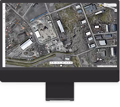
Greindu framvindu verkefna hratt og örugglega með drónum og úrvinnslu gagna þeirra í DATACT
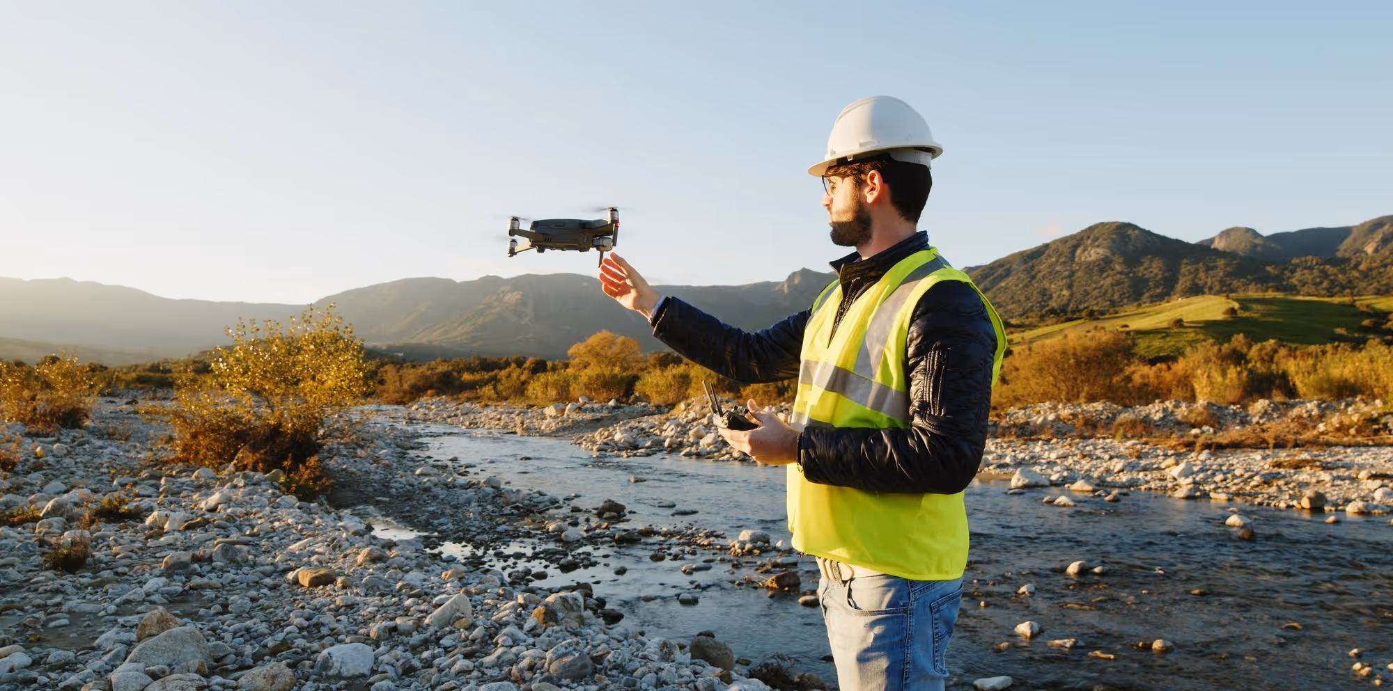
Breyttu drónamyndum í þrívíð líkön og hnitsettar loftmyndir
Sjálfvirk gagnaúrvinnsla
Þú hleður upp drónamyndum, DATACT vinnur úr þeim í skýinu. Þú þarft ekki að vera sérfræðingur í landupplýsingum eða kortagerð.
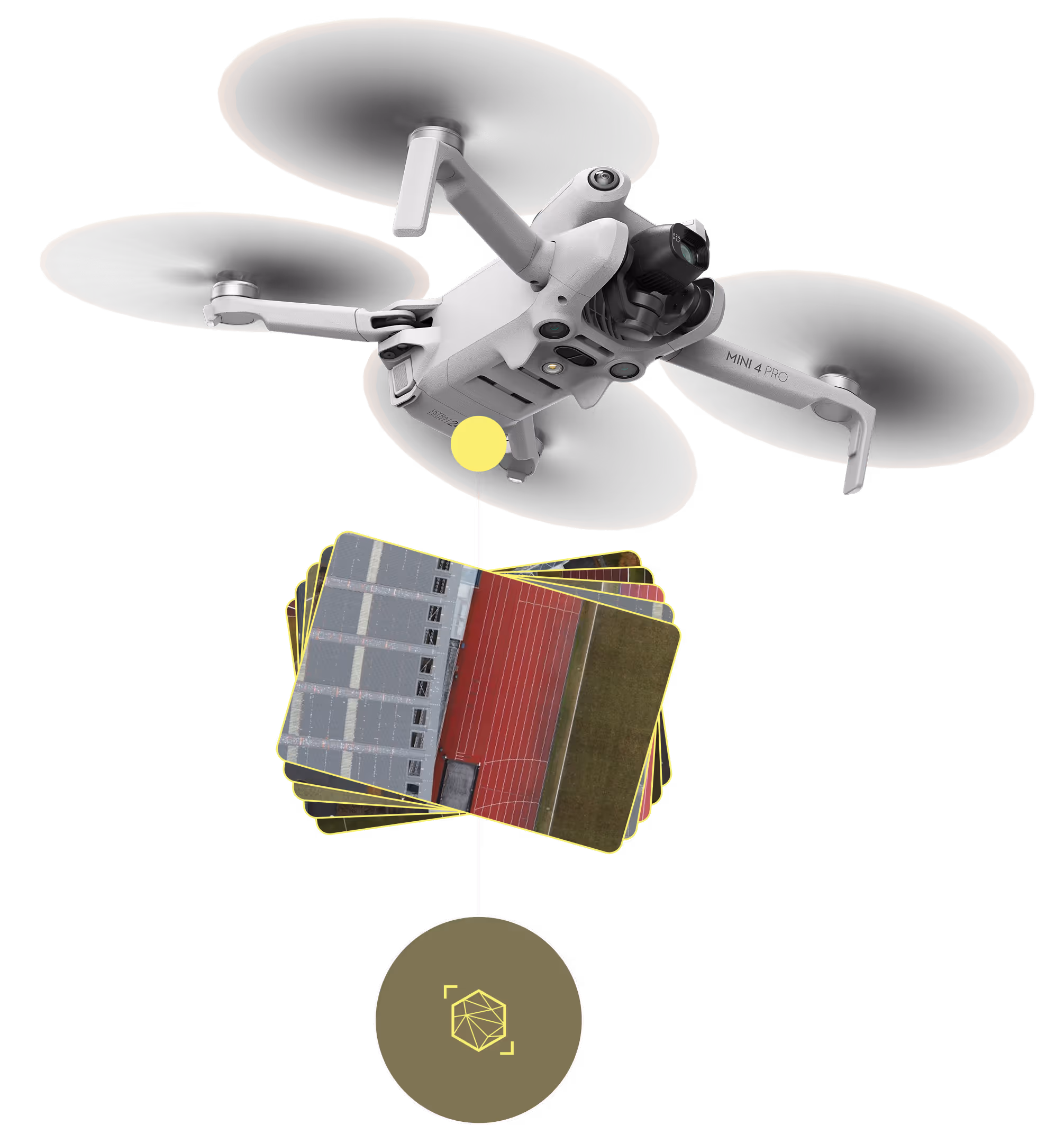
Þinn dróni. Þín gögn. Einfaldað.
Nýttu fólk sem er þegar á svæðinu
Safnaðu gögnum
Miðlægt og aðgengilegt
Upplýsingar sem skipta máli
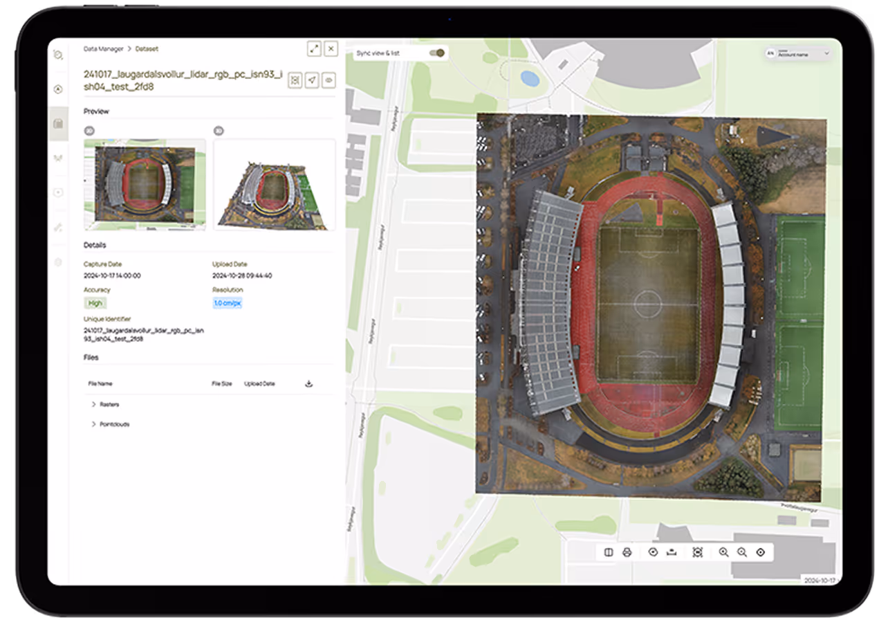
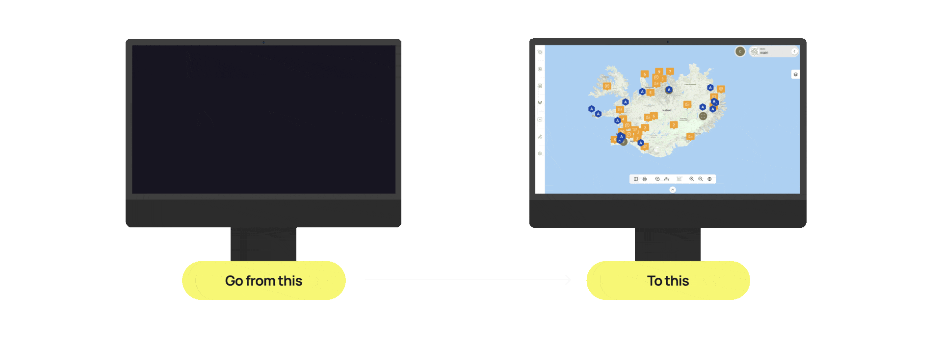
Þú finnur öll gögnin þín á kortinu
Hættu að eyða tíma að leita í minnisblöðum, dagbókum eða möppum eftir ljósmyndum og öðrum vettvangsathugunum. Færðu gögnin yfir á kortið þar sem auðvelt er að leita og finna rétt gögn strax.
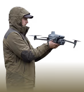
Sjálfvirkur dróni
Tengdu nýjasta starfskraftinn við DATACT

Svarmi sér um:
Uppsetningu
Leyfisveitingu
Hönnun flugferla/verkefna
Tengingu við DATACT
Viðhald og eftirlit
Þú færð:
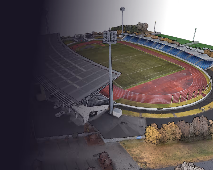
Stafrænan tvíbura af þínum verkstað
Viðbragðsaðila sem sefur aldrei
Nákvæm gögn sem nýtast í uppgjör
Einfalt og öruggt aðgengi að gögnum
Samstarfsvettvang með eftirlitsaðilum og verkkaupa
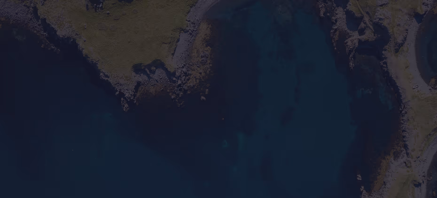
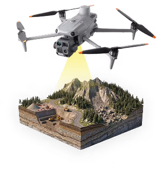
ER SNJÓR?
Í DATACT getur þú sótt gervitunglagögn fyrir valið svæði og tímabil á nokkrum sekúndum. Gagnast vel til þess að meta aðstæður á verkstað, t.d. hvort snjóþekja sé yfir svæðinu. Einnig má sjá grófa verkframvindu með því að ná í gögn frá mismunandi tímabilum.
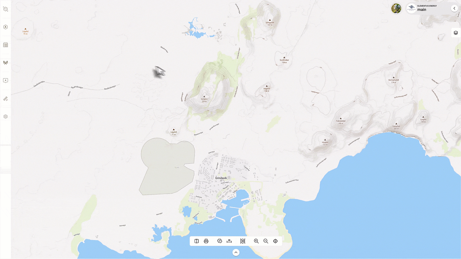
Einfalt aðgengi – Skoðaðu nýlegar og eldri gervitunglamyndir af hvaða stað sem er á örfáum sekúndum.
Birtist á sama stað og önnur gögn – Sameinaðu gervitunglagögn, drónagögn og vettvangsgögn á einum stað.
Fylgstu með breytingum – Fylgstu með umhverfisaðstæðum, gróðri eða landnotkun yfir tíma.
Samhengi milli vettvangsheimsókna – Fylltu í eyðurnar og haltu yfirsýn jafnvel þegar þú ert ekki á staðnum.
Engin uppsetning nauðsynleg – Gervitunglagögn koma beint í DATACT.
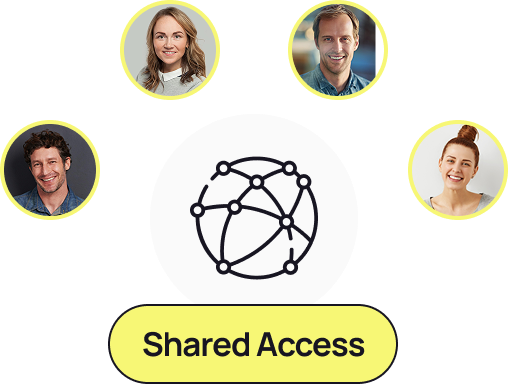
Samstarf og deiling gagna
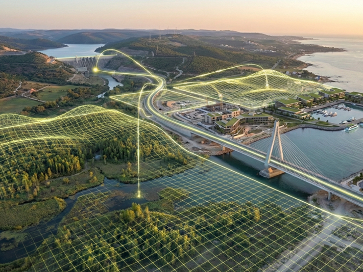
DATACT sameinar fólkið þitt og gögnin. Hvort sem þú tilheyrir tveggja manna teymi eða stórum vinnustað, þá brýtur DATACT niður gagnasíló með því að gera allar myndir, kort og landfræðileg gögn aðgengileg á einum öruggum vettvangi. Deildu upplýsingum, vinndu saman í rauntíma og stjórnaðu aðgangi áreynslulaust, án endalausra skráaflutninga eða týndra gagna.
Allt á einum stað
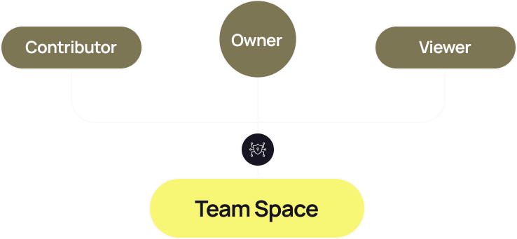
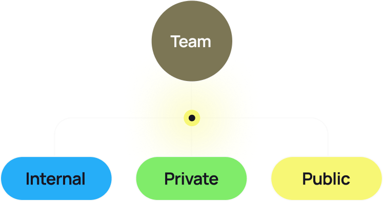
Vinnusvæði fyrir teymi
Hvert fyrirtæki hefur sameiginlegt Teymissvæði (Team Space) þar sem allir meðlimir geta nálgast gögn og lagt sitt af mörkum. Hlutverk eins og Owner, Contributor og Viewer stýra heimildum - sem tryggir sveigjanleika og öryggi fyrir teymi af öllum stærðum.
Rásir (Channels)
Rásir (Channel) eru gagnvirk vinnusvæði - dálítið eins og kort fyrir teymisvinnu.
Innri rásir (Internal Channels): Fyrir samvinnu innan fyrirtækisins. Allir í teyminu geta tekið þátt, skoðað og bætt við gögnum.
Lokaðar rásir (Private Channels): Fullkomnar fyrir viðkvæm verkefni eða vinnu á byrjunarstigi - aðeins boðnir meðlimir geta skoðað og lagt sitt af mörkum.
Opnar rásir (Public Channels): Deildu vinnu þinni með utanaðkomandi hagsmunaaðilum eða almenningi með einföldum tenglum, með fullri stjórn á sýnileika og niðurhali.
Bjóddu samstarfsaðilum
Bjóddu verktökum, ráðgjöfum eða samstarfsaðilum á einfaldan hátt inn í tilteknar rásir — leyfðu þeim að hlaða upp eða nálgast gögn án þess að veita fullan aðgang að kerfinu. Samvinnan helst markviss, stýrð og rekjanleg.
Örugg deiling gagna
DATACT ræður við stór gagnasöfn - tugi eða hundruð gígabæta - sem hefðbundin skráadeiling ræður ekki við. Í stað þess að hlaða gögnum upp og niður aftur og aftur, þá lifa gögnin þín örugglega á einum stað, aðgengileg viðurkenndum notendum á augabragði.
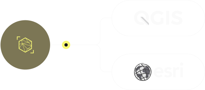
Samþætting við önnur kerfi
Streymdu gögnum beint í önnur GIS-kerfi með öruggum WMS-tenglum sem eru auðkenndir með API-lykli. Haltu landfræðilegu vinnuflæði þínu tengdu, engin þörf á að endurhlaða eða afrita gögn.
Af hverju þetta skiptir máli
Brjóttu niður síló – tengdu teymi, verktaka og hagsmunaaðila saman í einu umhverfi.
Sparaðu tíma – engin endurtekin upphal eða skráaflutningar; allir nálgast sömu upprunalegu gögnin.
Öryggi – stýrðu nákvæmlega hver sér hvað, með sveigjanlegum heimildum á rásum.
Deildu án hindrana – búðu til deilanlega hlekki fyrir innri, lokaðan eða opinn aðgang.
Myndræn samvinna – vinnið saman beint á kortinu, ekki í möppum.
Áskriftarleiðir
Essential
For individuals or small teams beginning with drone and field data
Designed for individuals exploring nature data management.
- 1 public channel
- 1 editing user
- 2 GB of storage and
- Basic pins for images, videos and notes
Professional
Advanced tools and workflows for growing teams and frequent missions
Designed for field teams collecting data regularly.
- 5 public channels
- 5 editing users
- 250 GB of storage
- Cloud-based drone data processing
enterprise
Scalable solutions – custom integrations and premium support
Designed for ambitious teams andlarger organisations
- Unlimited public channels
- Unlimited no. of internal users
- Custom storage options
- Cloud-based drone data processing
- Pins for images, videos and notes
Compare plans
Find the perfect plan for you
Byrjaðu að innleiða rauntímaeftirlit verka
