Advanced Data Collection

EXECUTIVE SUMMARY
High-quality, timely, and accurate data is the bedrock of any successful environmental, infrastructure, or Nature-Based Solution project. Acquiring this data, however, requires specialized expertise, equipment, and global reach.
Our Advanced Data Collection & Remote Sensing service provides a comprehensive solution for all your aerial and satellite data needs.

Our Data Collection Philosophy
Precision, Empowerment,
and Speed
Our approach is designed to ensure you get the right data, the right way, to achieve your project goals.
001
Battle-Tested Precision & Quality
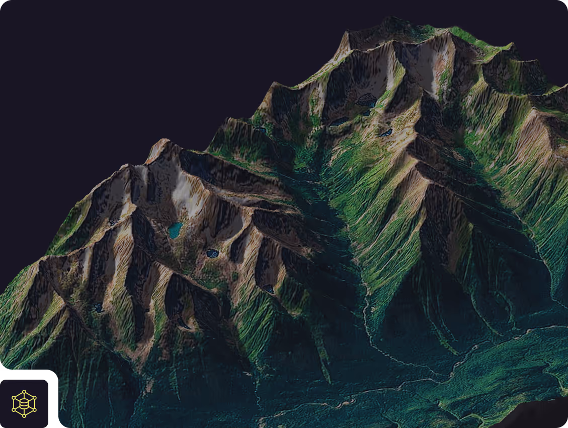
Our expertise is built on over 12 years of hands-on, in-the-field data collection with drones across multiple continents. We have successfully operated in some of the world's most demanding environments—from the low temperatures, high winds, and challenging weather of Iceland to the soaring heat and high altitudes of Ethiopia. Our team has proven experience mapping dynamic and hazardous events, including active volcano eruptions, avalanche paths, and flood zones. We've seen it all, and this battle-tested experience means we adhere to the highest standards, ensuring every dataset is accurate, reliable, and fit for purpose, no matter the conditions.
002
Client Empowerment
We believe in enabling our clients. Our goal is not just to deliver data but to provide you with the tools and knowledge to succeed. We offer flexible models that allow you to be as hands-on or as hands-off as you wish.
003
The DATACT Advantage
All data we acquire is delivered directly into the DATACT platform. This provides your team with immediate, secure access for viewing, sharing, and collaboration, without the need for specialized software or powerful computers.

Our Core Capabilities
We offer a complete suite of data acquisition and planning services, tailored to your specific project needs.
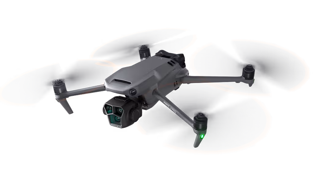
Advanced Drone Data Collection
We deploy state-of-the-art drones equipped with a range of sensors to capture high-resolution data for detailed analysis.

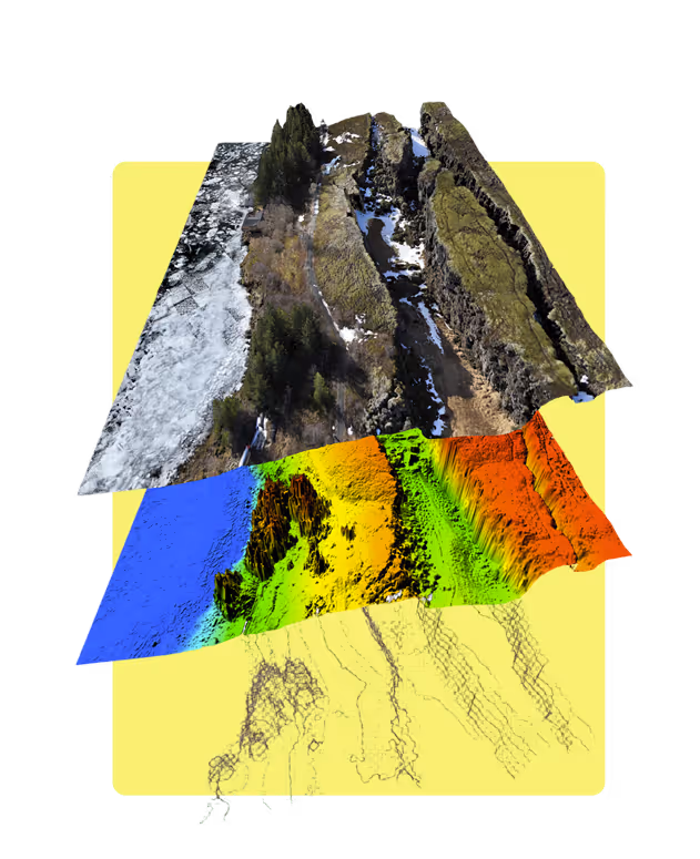
Our Sensor Fleet Includes: High-Resolution RGB: For detailed visual inspection and creating photorealistic 3D models and orthoimages.
- RGB: High-resolution, full-frame cameras delivering superior image sharpness and geometric accuracy.
- LiDAR: For creating highly accurate 3D point clouds and Digital Terrain Models (DTMs), essential for forestry, engineering, and hydrological analysis.
- Multispectral: For advanced vegetation health analysis (e.g., NDVI), agricultural monitoring, and environmental science.
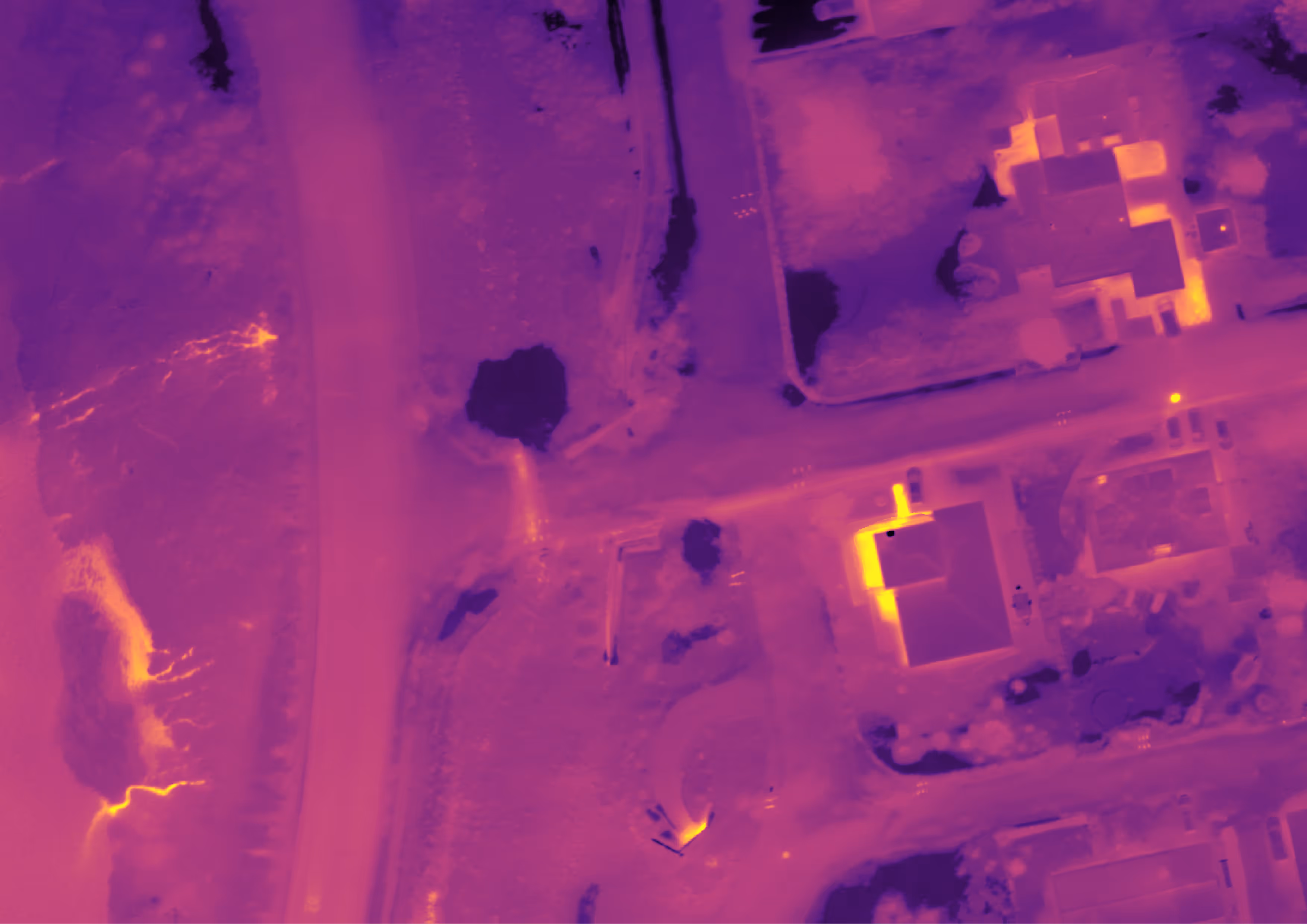
- Thermal: For detecting heat signatures, useful in infrastructure inspection, wildlife surveys, and geothermal mapping.
End-to-End Service: We can manage the entire workflow: mission planning, field collection, data processing, and final delivery of analysis-ready products through DATACT.
Satellite Imagery Acquisition & Subscription
We provide access to a world of satellite data, from freely available archives to the highest-resolution commercial imagery
Provider Agnostic: We source data from any provider to meet your project's specific resolution, frequency, and budgetary requirements. This includes:
- Free Public Data: Sentinel (ESA) and Landsat (NASA/USGS).
- Premium Commercial Data: High-resolution imagery from providers like Planet, Maxar, and Airbus.
Monitoring Subscriptions: For projects requiring ongoing observation, we can establish and manage a subscription service, delivering new imagery of your area of interest directly to DATACT as it becomes available.
Custom Mapping & Monitoring Plans
We develop strategic data collection plans to ensure you get the most effective data coverage in the most efficient way.
Hybrid Approach: We design plans that intelligently combine drone and satellite data. For example, using satellite imagery for broad-area monitoring to detect change, then deploying drones for high-resolution investigation of specific areas of interest.
- Strategic Planning: We work with you to define the optimal revisit frequency, sensor type, and resolution to meet your monitoring goals and budget.
End-to-End Service: We can manage the entire workflow: mission planning, field collection, data processing, and final delivery of analysis-ready products through DATACT.

Flexible Delivery Models
Your Project, Your Way
We offer a fully flexible approach to data collection, ensuring a perfect fit for your team's size, budget, and technical capabilities.
Model A
Full-Service Data Acquisition
Our expert team manages the entire data collection process from start to finish. This is the ideal hands-off solution for clients who need guaranteed, high-quality results without dedicating internal resources.
Model B
Hybrid & Coordinated Collection
We act as an extension of your team. This model is perfect for large-scale projects or when specialized equipment is required.
Example Scenarios:
- We supplement your field team to cover a large area faster.
- We deploy a specialized LiDAR sensor that you don't own, while your team collects RGB drone data.
- We coordinate a network of contractors for a multi-national project, ensuring data consistency.
Model C
Client Empowerment & Training
We empower you to become self-sufficient in your data collection efforts.
- Dedicated Training Courses: We offer comprehensive, hands-on courses on how to plan and execute drone mapping missions to the highest standard. Register here
- Automated Processing in DATACT: We teach your team how to upload their collected data directly to the DATACT platform for fully automated photogrammetry processing, turning their images into valuable orthoimages and 3D models. Request a course
We can help you uncover invisible anomalies.
Detect leaks or other anomalies using thermal data and RGB data, try for yourself.
.avif)

%201-min.avif)
Model C
Master Professional Drone Mapping
Empower your team to capture high-quality data independently.
Learn from the experts at Svarmi. Our hands-on courses are designed to make you self-sufficient in drone operations, from navigating EU regulations to executing flawless photogrammetry flights for our DATACT platform. Future-proof your team, reduce downtime, and take control of your data collection.
Our Global Experience
While proudly based in Iceland and Switzerland with over a decade of intensive mapping experience, our reach is global. We have successfully delivered projects across continents, including extensive work in Europe, Africa, and South America. We leverage our experience and our vetted network of international drone operators to deliver consistent, high-quality results, no matter where your project is located.
Talk to our geospatial experts
about your next project.
Get tailored advice and find out how
our analysis can support your goals.
